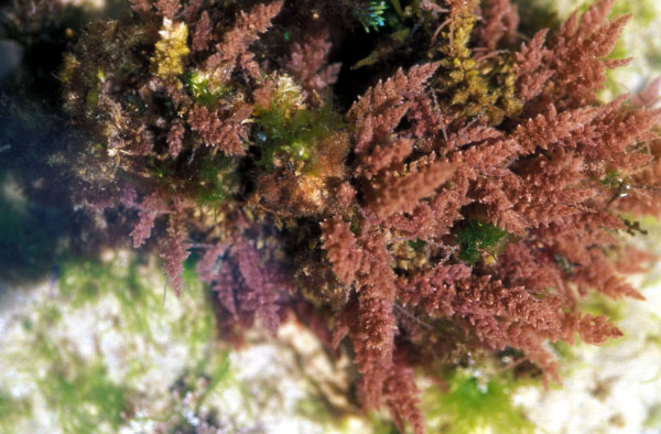
Falkenbergia rufolanosa Harvey
Pale purplish-red, quickly degenerating when removed from the water and becoming distinctly orange; fronds bushy, with a cylindrical axis to1 mm wide and 200 mm long. Both phases readily reproduce vegetatively. Photographs by M.D. Guiry

Development and Application of a GIS-based Long Island Sound Eelgrass Habitat Suitability Index Model
The primary objectives of the Eelgrass Habitat Suitability Index Model (EHSI Model) are to assist in the evaluation of sites being considered for eelgrass restoration efforts in the Long Island Sound (LIS) area and to identify areas where water quality issues reduce or eliminate the potential for natural eelgrass colonization. To achieve this goal, geospatial processing of data available from the Long Island Sound area was conducted using ArcGIS v10.0 including the 3D Analyst and Spatial Analyst extensions. The result is a series of maps presented in this report and a GIS-based model available for users to interact with the results and formulations of the model.


